

geocomp.com.au
Geocomp SystemsGeocomp Systems provides comprehensive software systems for civil engineers, terrestrial and hydrographic surveyors and cartographers.
http://geocomp.com.au/
Geocomp Systems provides comprehensive software systems for civil engineers, terrestrial and hydrographic surveyors and cartographers.
http://geocomp.com.au/
TODAY'S RATING
>1,000,000
Date Range
HIGHEST TRAFFIC ON
Tuesday
LOAD TIME
0.6 seconds
16x16
32x32
PAGES IN
THIS WEBSITE
14
SSL
EXTERNAL LINKS
36
SITE IP
202.191.62.229
LOAD TIME
0.561 sec
SCORE
6.2
Geocomp Systems | geocomp.com.au Reviews
https://geocomp.com.au
Geocomp Systems provides comprehensive software systems for civil engineers, terrestrial and hydrographic surveyors and cartographers.
 geocomp.com.au
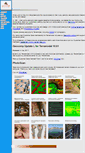
Geocomp Systems software support
http://geocomp.com.au/support
Local support around the world. Newsletters including Expert Advice. Plotting, drivers and utilities. Download and install Terramodel and Geocomp Update. Dongles, security, keys, locks and system drivers. Coordinate Conversion, HDMS and Visualizer. Transfer data to and from Trimble survey, GPS and machine control instruments. Transfer data to and from Leica 1200/VIVA survey, GPS and machine control instruments. For FAQ, manuals, etc., run DOCUMENT command in Terramodel with Geocomp Update.
Trimble Terramodel
http://geocomp.com.au/terramodel
What's new in Trimble Terramodel? Trimble Terramodel is an integrated application for civil engineers, surveyors and anyone else who needs to work with terrain models or alignment design. Work in English, Spanish, French or German. Convert data easily between Trimble Terramodel and many other applications. Purchase Terramodel from Geocomp Systems, and get Geocomp Update. Included with hundreds of new and improved features. Field data, CAD and Geocomp Update Modules. For surveying and drafting. Display an...
iWitness
http://geocomp.com.au/iwitness
Imagine this. You are called to survey a complex structure you can't reach such as a crane and you just have your ordinary digital camera with you. Take a few photos, and that's your field survey done! That fancy software is now available from Geocomp Systems for less than you'd think. IWitness is a digital photogrammetric system for easy 3D coordinate measurement on your computer using photos from your digital camera. With iWitnessPRO, you can use special targets to start measuring even faster.
PhotoScan
http://geocomp.com.au/photoscan
Point clouds for everyone. Imagine this. You have haven't got a laser scanner but you do have a camera. You have seen wonderful 3D images and point clouds created by specialist companies and you wonder if you could ever have the skills or cash flow to create such a thing for your clients. And if you could, what practical application would you have for them? With PhotoScan software, photos, and your computer, you could:. Create and edit coloured point clouds. Measure distances, areas and volumes.
Paydirt
http://geocomp.com.au/paydirt
Paydirt is designed for estimators, not computer experts. If you can read construction plans and use Windows 95 or later, you can trace plans into a computer with a digitiser and get accurate volume reports out quickly, often in less than an hour. From Trimble. For estimators who need to not only calculate quantities from paper plans but to perform a detailed analysis of their project. SiteWork 5.23 includes Terramodel. CAD for data manipulation and exchange. Available in Lite and Advanced.
TOTAL PAGES IN THIS WEBSITE
14
Projects: Yemen
http://www.geocomp.nl/3_1.php
Mali - Office de Niger. Supply of Land Survey and Civil Engineering software to the National Water and Sanitation Authority and training of their staff to use the software and hardware. The NWSA choose Geocomp because the short learning curve, the reliable output and the support beaten by no one. They will use the software in the most remote areas of the country to rehabilitate dams and irrigation schemesand design sewage systems. A world Bank Project.
Geocomp International - sitemap
http://www.geocomp.nl/sitemap.php
Mali - Office de Niger. Geocomp International - Home. Sokola - World Bank. Mali - Office de Niger.
Geocomp International
http://www.geocomp.nl/index.php
Mali - Office de Niger. Geocomp International offers a total solution for Land Survey and Civil Engineering Projects. We represent Geocomp Systems, developers of Geocomp. And are a qualified Trimble. Geocomp represents Geocomp Systems in Europe, Africa and the Middle East. Geocomp is a member of the Netherlands Water Partnership. International Federation of Surveyors. American Congress on Surveying and Mapping.
Projects: Mali - MCC project
http://www.geocomp.nl/3_5.php
Mali - Office de Niger. Mali - MCC project. A Hydrographic survey of a 160 km long fallah. Creation of a DTM, extraction of crossections, a long section. SCET Mali has been responsible.
Geocomp
http://www.geocomp.nl/geocomp.php
Mali - Office de Niger. Is an ideal toolkit for surveyors and civil engineers, providing modular packages that can be used in the field to edit data. It is then used in the office with several other modules to perform geodetic network adjustments, build digital terrain models, generate contours, extract X-sections and volumetric calculation. Systems' famous DOS civil and survey application is up to version 10.08.
Services
http://www.geocomp.nl/services.php
Mali - Office de Niger. Monitoring of construction sites. Set out of all types of civil and structural projects. Control and survey of large scale earthworks. Monitoring of settlement, deformation and potential slide. Exploration grids and topographic mapping. Haul roads, location of mine infrastructure and site survey. Excavation, quantity survey and calculations. Selection and survey of routes for roads, transmission lines, canals, pipelines, railways and conveyor belts. Airport and approach paths.
GeoCalc
http://www.geocomp.nl/geocalc.php
Mali - Office de Niger. Converts coordinate data files between most of the commonly-used mapping systems world-wide. Has user-definable parameters allowing deployment anywhere in the world on almost any spheroid or mapping system. Includes a large number of predefined mapping systems and spheroids. Includes Geodetic Datum of Australia. Compares geodesy of the same point in two different mapping systems. Displays point scale factor and grid convergence. Is a 32-bit Windows application. New Zealand Map Grid.
Trimble Terramodel Visualizer
http://www.geocomp.nl/terramodel_vis.php
Mali - Office de Niger. Visualizer is an interactive project-visualization tool. That displays Terramodel files as 3D models. Display togographically-accurate terrains, maps and 3D scenes built using Trimble Terramodel. Move from point to point, rotate the scene, add lighting, and place design elements in the surrounding area. Render data to create realistic walk or fly-throughs. Create and record flight paths through the project and produce .AVI movies of recorded flight paths. Please contact Jerry Cresp.
iWitness
http://www.geocomp.nl/iwitness.php
Mali - Office de Niger. Imagine this. You are called to survey a complex structure. You can't reach such as a crane and you just have your ordinary digital camera with you. Take two photos, and that's your field survey done! Imagine this. You are called to survey a complex structure you can't reach such as a crane and you just have your ordinary digital camera with you. Take two photos, and that's your field survey done! Simple to use with automatic processes. Rigorous, robust photogrammetric orientation.
TOTAL LINKS TO THIS WEBSITE
36
Vector InfoSystems - System Integrator and IT Support Service Provider!
We're an IT support specialist and system integrator company - building and maintaining Information Technology infrastructures - for businesses throughout the Singapore Island and Asia region. We are IT professionals holding highly acclaimed industrial certificates, such as MCSE, MCP I and CCNA. Having more than 8 years of experience at management and higher technical roles makes us a strong force in the industry . [ Find out more. We are Microsoft Small Business Specialist. We are HP Business Partne.
GEOCOMP-PERU
Triaxial y trayectoria de Esfuerzos. Texto de la imagen texto de la imagen texto de la imagen texto de la imagen texto de la imagen texto de la imagen. Texto de servicios texto de servicios texto de servicios texto de servicios texto de servicios texto de servicios texto de servicios. GRACIAS POR EL INTERÉS EN NUESTROS SERVICIOS. Para la operación de nuestros equipos. Soporte técnico mantenimiento y repuestos de nuestros equipos. Calibración de nuestros equipos. AQUI UN SLOGAN DE LA EMPRESA GEOCOMP-PERU.
Geocomp – Computer – Netzwerk – Internet
Computer – Netzwerk – Internet. Netzwerk & Internet. TerraCAD Das CAD-System für Vermessungswesen. TerraGDB / V408 WebGDB. ZWCAD Die Autocad Alternative. Ihre Soforthilfe bei EDV-Problemen. ESET Gold-Partner – Virenschutz für ihren Computer. TerraCAD – Das CAD-System für Vermessungswesen. Wir planen, realisieren und betreuen Ihre EDV. Wir erarbeiten das Sicherheitskonzept Ihrer IT-Infrastuktur. Eigene Softwarepalette für Vermessungswesen. Tel 07672 / 27 777 -0. Fax 07672 / 27 777 -77.
GeoComp Junior Mining Video Productions
The Power of Video. You have less than a minute to convince this potential investor to look into your company further. What do you use.text or video? Effective Communication With Todays Investors. Today multimedia is the most effective, affordable and engaging method for communicating your story or news to your shareholders and the investment community at large. Getting and Keeping Their Attention. Therefore, if you are going to be successful in your communication efforts you MUST. Is the most effective ...
Geocomp - Providers of Professional Geostructural Services and Products
Geostructural Design and Consulting. Failure Analysis and Rehabilitation. Laboratory Testing and Field Testing. Geocomp provides services and products to help clients identify and manage risk associated with the design, construction and operation of infrastructure. Newsletter 4th Quarter 2017. Reduce Risk on Solid Waste Projects with Expert Geosynthetic and Soil Testing. Video: Dr. Allen Marr 2017 CSIC Distinguished Lecture Series. Sign Up For Newsletter. More News ». Data Reduction & Analysis.
Geocomp Systems
Once upon a time, Civil Engineers and Surveyors relied on their trusty pencils, calculators and theodolites to survey and design. In 1981, when computers and data loggers became more available, we created Survey Computing Consultants. Soon our customers were buying their own computers to run our Geocomp. Software and so we became Geocomp Systems. Now we help our customers to survey and design with Windows software such as Trimble Terramodel. We also develop add-ons for Terramodel, including HDMS.
Welcome!
Welcome to your website! This is the default index page of your website. This file may be deleted or overwritten without any difficulty. This is produced by the file index.html. For questions or problems please contact support.
Geocomp - Mayorista de bolsos desde 2004
Bienvenido a GeoComp - Mayorista de bolsos. Bolsos De Mano Mujer. Llaveros al por mayor. Bolsos De Mano Mujer. Llaveros al por mayor. Si eres profesional estas en el sitio perfecto en nuestra tienda online vas a poder comprar bolsos al por mayor. Somos mayoristas de bolsos desde 2004. Ahora en todos los pedidos. Sean del importe que sean te regalamos una cartera de Mujer. El modelo de cartera que reglamos es aleatorio, cada semana u modelo nuevo. Bolso de viaje y deporte. Bolso de viaje y deporte. 8211; ...
Geocomp - consulenza e forniture alle enti locali - reti tecnologiche e gestione del patrimonio
Opera dal 1990 nel campo della gestione del territorio e ha iniziato il suo percorso progettando sistemi informativi geografici. Per importanti strutture operanti a livello nazionale. Si avvale dell’esperienza di tecnici che da anni operano nel settore informatico, dell’indagine e della ricerca per fornire un servizio di collaborazione ad alto valore aggiunto. La nostra attività è rivolta principalmente agli enti che operano sul territorio, pubblici, privati e società municipalizzate. La gara per I’attiv...
Price Request - BuyDomains
Url=' escape(document.location.href) , 'Chat367233609785093432', 'toolbar=0,scrollbars=0,location=0,statusbar=0,menubar=0,resizable=0,width=640,height=500');return false;". Need a price instantly? Just give us a call. Toll Free in the U.S. We can give you the price over the phone, help you with the purchase process, and answer any questions. Get a price in less than 24 hours. Fill out the form below. One of our domain experts will have a price to you within 24 business hours. United States of America.
GeoComp
Nasza strona wykorzystuje pliki cookies ( polityka prywatności i cookie. Portal Wykonała Agencja Reklamowa WebNext.